What We Do
Visualization of Risk and Vulnerability
We source, analyze, and visualize global and local datasets to identify and communicate complex and interconnected risks. We specialize in supporting partners with visual communications tools and maps that can support actionable stakeholder engagement and decision-making.
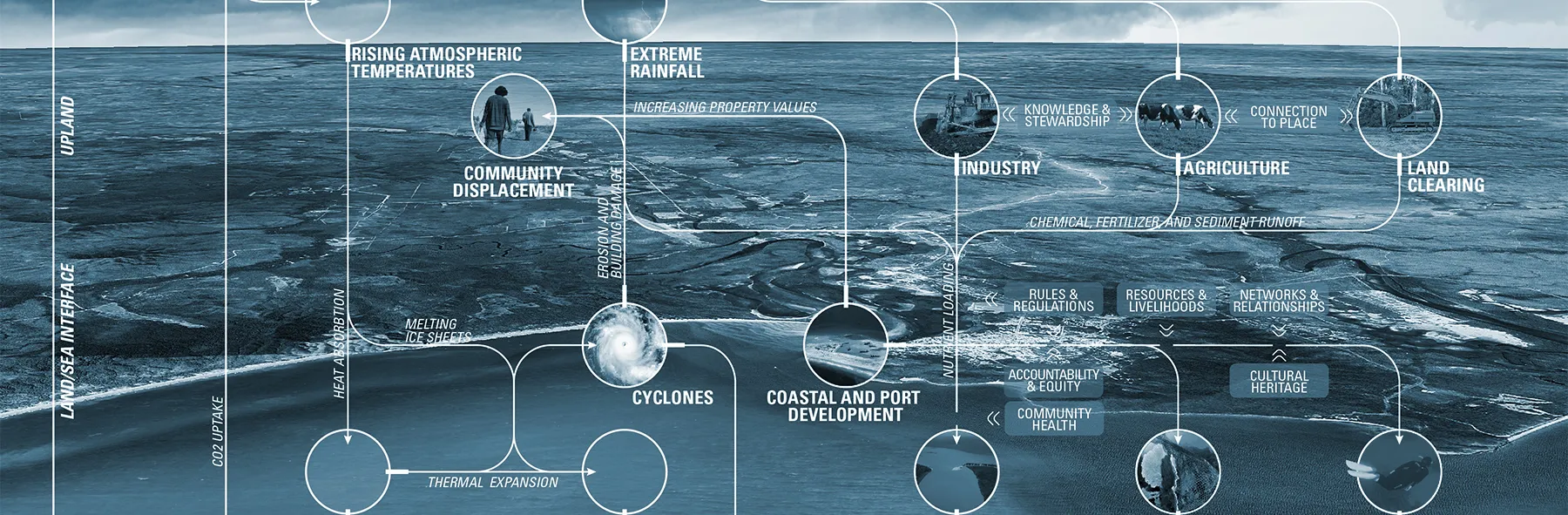
Coral reefs and adjacent ecosystems and communities face a set of interconnected shocks and stresses - some driven by local actors and others by global climate change. Stresses, such as agricultural runoff or overfishing, undermine the health and resilience of the reef ecosystems, its capacity to function as a coastal defense, and its ability to support livelihoods and communities. Shocks, such as cyclones or coral bleaching can exacerbate the impact of those stresses. However, the assets and values within a system are critical pushbacks on shocks and stresses, and provide entry points for transformation by reef communities. Together with the Great Barrier Reef Foundation Resilient Reefs Initiative, we developed a comprehensive visualization of systemic hazards, vulnerabilities, and assets facing reef systems. The diagram serves as a communications tool for Chief Resilience Officers of UNESCO World Heritage Reef sites participating in the program. The visualization aims to uncover systemic connections in the landscape, communities, land uses, and global climate trends in order to position how actions must meet systemic issues, generate multiple benefits, and also leverage assets and strengths. We considered a wide range of risks from global to local and considered their spatial placement: marine, land/sea interface, upland, and atmospheric. We examined catalytic and multiplying impacts. For example, greenhouse gas emissions and rising temperatures that drive ocean acidification to upland land uses like agriculture and land clearing that contributes to runoff and nutrient loading and impacting reef species.

Vulnerability can be understood as the combination of exposure and sensitivity. Through our Resilience Accelerator partnership with Tel Aviv-Yafo, we synthesized some of the key factors associated with heat vulnerability city-wide and then visualized heat exposure and microclimate in a particularly at-risk neighborhood, Shapira. First, by mapping remotely sensed data from the thermal sensor of the Landsat 8 satellite and areas of the city that most “built up” using the Normalized Difference Built- Up Index (or NDBI), also derived from Landsat, we showed exposure to heat and the built-up surfaces that can exacerbate heat. We also worked with the Municipality to prepare a spatial sensitivity analysis, mapping demographic indicators including: elderly, elderly living alone, infant, lower education, lower income, large households, single-parent households, and the unemployed. By layering all of these factors in a single composite map, creating what is known as a “multi-criteria decision analysis map,” we uncovered and prioritized neighborhoods disproportionately impacted by heat. Then, in close partnership with the Tel Aviv University Urban Climatology Lab, we visualized land surface temperatures and the findings of a comprehensive microclimate study of the neighborhoods alongside the results of a community survey in Shapira. All together, this is helping the community, planners, and designers to understand the complexity of microclimate and how to rethink public spaces and future planning.

Case Study Research
We synthesize learnings from past projects and global best practices in design, planning, and policy of resilience-building projects and plans. We aim to uncover the processes that delivered projects to best inform implementation learnings and shape case studies in service of the specific questions that our partners are facing.
Our operating definition of resilience prioritizes learning lessons from the past, assessing actions across multiple scales and sectors, and anticipating future risks. It embraces complexity and adopts an ecological perspective on the socio-economic activities of human settlement, manifest in physical places. If, as we believe, transportation is a catalyst for growth, resilience thinking anticipates ways in which such growth, in concert with increased connectivity, can enable social inclusion and support ecological consciousness. As a follow up the Resilience Accelerator in The Hague we prepared selected examples that can begin to illustrate the ways that transportation projects affect the global climate system, the communities that they serve, and the institutions that deliver them. Through the efforts, we explored nine major transportation investments: Lynenburg Corridor, Amsterdam North South Line, Medellin MetroCable, Mexico City Metrobus, Boston Fairmount Line, Tskukuba Express, Souterrain Tram Tunnel, Mombasa-Nairobi Standard Gauge Railway, and the Hudson Yards 7-Line Extension. Each case study presents a range of reasons why a project came to be, how it evolved during project planning and implementation, and a critical assessment of its beneficial or deleterious consequences. Through the process, we established an evaluation criteria by which to consider each case study that considered local, regional, systemic, and global factors and synthesized major lessons learned.
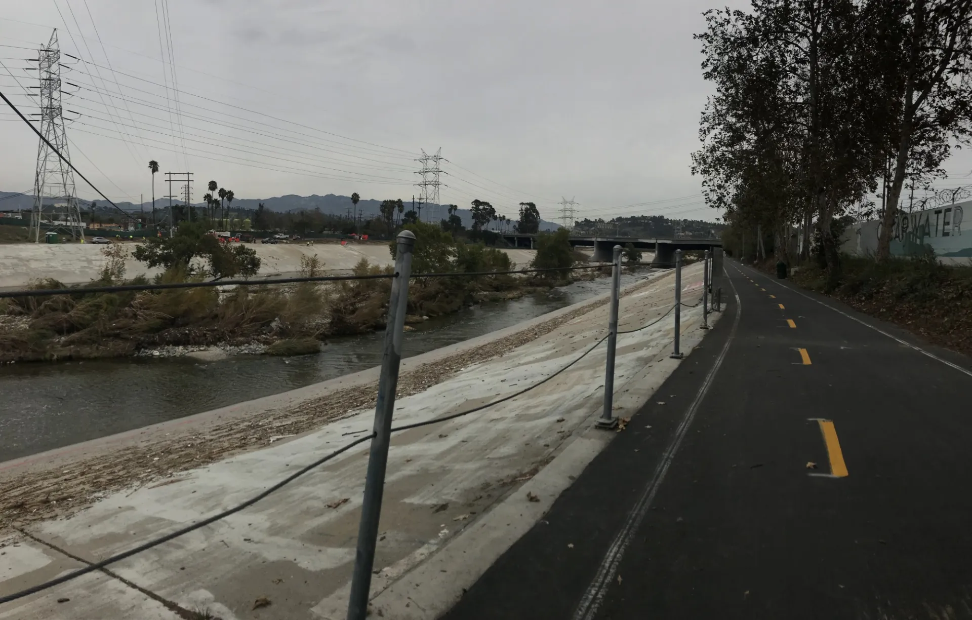
The City of Los Angeles is acting on an opportunity to invest in the built environment and support the resilience of its communities by addressing the impacts of insufficient affordable housing, displacement of jobs and residents, mobility demand, and climate change impacts. Over the last decade, Resilient Los Angeles and master planning efforts for the Los Angeles River, have not only brought these issues to the fore, but also opened new opportunities to explore new models for redeveloping or programming City-owned land adjacent to the LA River that promote greater community-based resilience outcomes. Through our partnership with the City of LA and LA RiverWorks on the Resilience Accelerator program, we developed a set of case studies that would inform a workshop that brought together private sector actors, City staff, and community activists in exploring new development models for City-owned sites along the LA River that drive resilience goals at the City and community scales. Case studies looked at a range of case studies that represent a range of redevelopment and implementation models, such as river-adjacent properties, joint uses of conversion from industrial to residential or mixed-used, open space development, sustainable development, and various deal structures between municipal authorities and private developers or community development corporations. Case studies include 12th Avenue Arts in Seattle, Lincoln Heights Jail in Los Angeles, Riverplace Parcel in Portland, and Upham’s Corner in Boston. Each case study identifies the vulnerabilities that the project addresses and impacts, the enabling environment and financing strategies that made implementation possibles, a project development timeline, and key lessons learned gleaned from interviews with project stakeholders.
Scenario Planning
We visualize and lead efforts that help to clarify interactions of multiple variables over time and help stakeholders understand long-term impacts of projects at multiple scales. Scenario planning can include visualization of project outcomes, facilitated discussions around possible future conditions, and inquiry into social, ecological, and infrastructure pressures with or without projects. They are particularly useful in helping stakeholders to define criteria for new projects, plans, and policies.
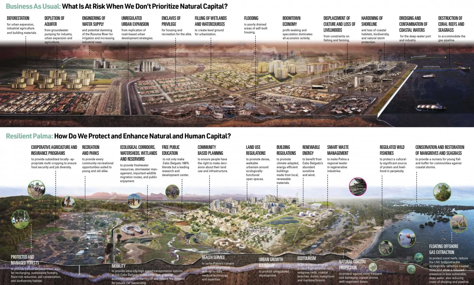
Cabo Delgado, Mozambique is a place of great ecological and cultural wealth. It also contains Africa’s fourth-largest known deposit of liquefied natural gas offshore. The extraction of this gas and subsequent urban growth is assured in the years to come. The town of Palma is expected to grow from 20,000 to at least 200,000. How these developments will affect the country’s existing natural and social capital remains to be seen. On August 20 and 21, 2018, the Center for Resilient Cities and Landscapes (CRCL), World Wildlife Fund, and Columbia University’s GSAPP conducted a five-day workshop in Maputo. This workshop provided a forum for the major stakeholders in the economic development of northern Mozambique--- government, civil society, communities, and the private sector--- to collectively understand the threats and opportunities that gas exploration, rapid growth, climate change, and related factors pose to the region. CRCL used the resulting knowledge and information to develop visualizations of potential futures for Palma. One shows the business-as-usual consequences of resource extraction and unmanaged growth; the second considers climate resilience, social justice, and circular and sustainable economies.
Workshop Facilitation
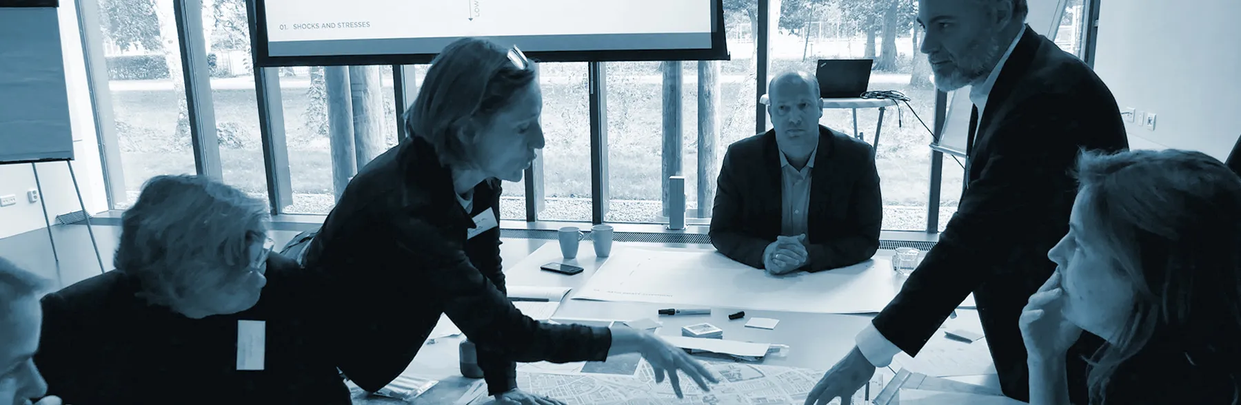
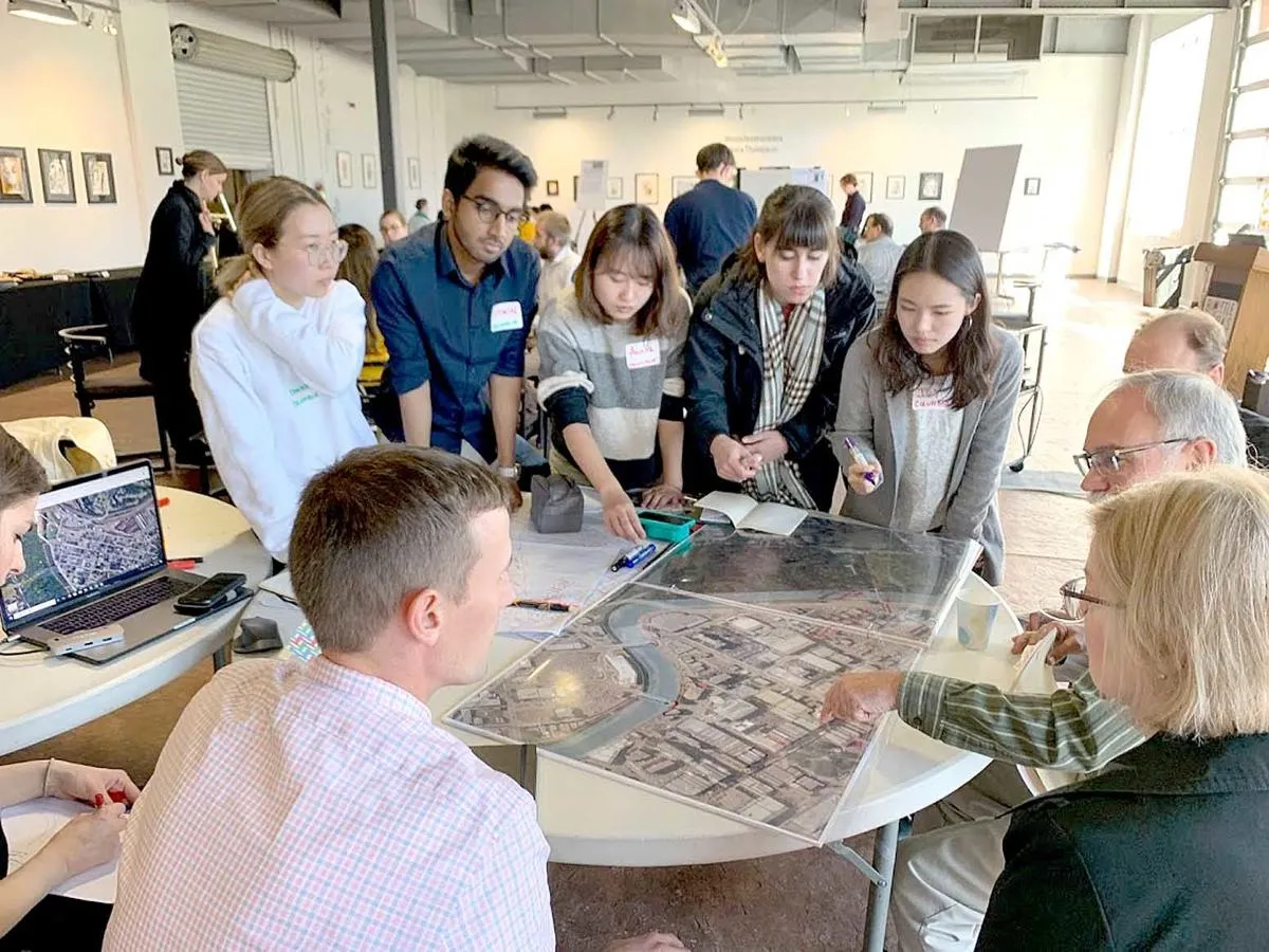
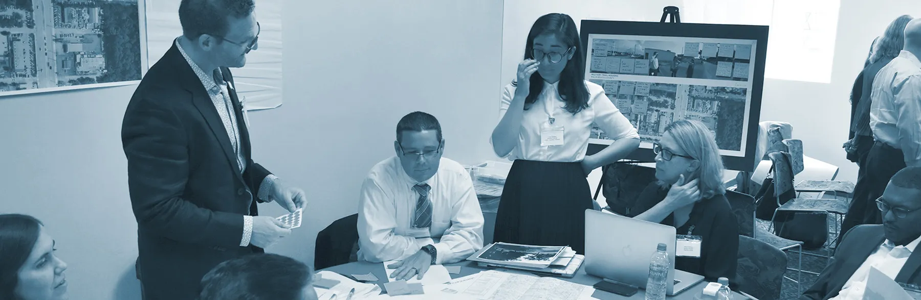
We design, organize, and facilitate research- , design-driven, and place-based workshops to build consensus and create an enabling environment for decision-making. Workshops aim to bring together stakeholders from local government, academia, and community groups to co-design projects and implementation strategies. Often, outside funders and senior level officials are included in workshops to accelerate action and local commitments. We draw on our wide network of resilience practitioners, designers, and scientists as well as expert facilitators to deliver technical expertise and encourage productive disruption to status quo ways of working.
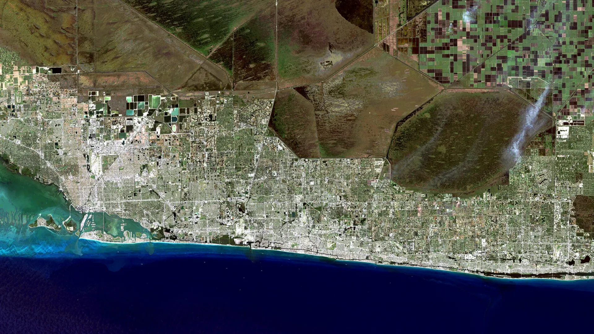
Widely recognized as ground zero for climate change adaptation in the U.S., Southeast Florida is one of the nation's fastest growing regions and one of the most exposed to ever more threatening coastal storms and regular tidal flooding from sea level rise. The Accelerator team designed and delivered a three-day workshop in August 2018 to support the City of Miami Beach, the City of Miami, Miami-Dade County West Palm Beach, and Palm Beach County in their effort to embed resilience value into selected projects. The workshop was designed to encourage project owners and stakeholders to consider how their projects have a larger impact on the South Florida region’s greater resilience efforts at five sites: Monceaux Park in West Palm Beach, Military Trail in Palm Beach County, West Avenue in Miami Beach, Brickell Bay Drive in the City of Miami, and South Corridor in Miami-Dade County. Workshop participants were organized into working teams by site, supported by local designers and academic experts, and critical stakeholders, such as the Miami Beach Fire Department. Teams were challenged to define design strategies as well as funding, scaling, and stakeholder engagement processes that they could operationalize following the workshop. At the end of the workshop, teams presented their plans and projects to the public, senior officials, and members of the press to demonstrate their collective commitment to advancing projects.
A resilient city is one that can survive shocking events like floods, adapt to ongoing challenges like a more global economy, and thrive today and for generations to come. Often resilience builds up by gradual improvement. But when there is an escalating crisis, resilience should be accelerated. On October 28, 2019, Johnstown Vision 2025 and Columbia University Center for Resilient Cities and Landscapes hosted a workshop at the Bottleworks Arts Center in Johnstown. Local leaders came together with graduate students from Columbia University to discuss how to make the area’s infrastructure more resilient. During the workshop, we considered how resilience could be accelerated through coordinated public investments in transportation, housing, arts and education, economic development and green infrastructure.
Implementation Planning
We generate reports and visual communications tools that synthesize actions needed to advance project design and implementation as determined by workshop stakeholders. These plans can consist of: workshop synthesis documents and decision-making frameworks, presentation of research materials that suggest policy and design options, and visualization of design directions.
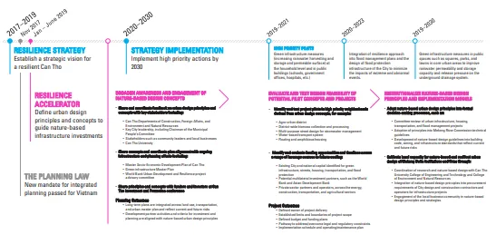
Can Tho City has an opportunity to rethink development to support urban growth, climate adaptation, and long-term resilience to interconnected regional risks. By integrating nature-based infrastructure into its growth strategies, Can Tho can avoid the mistakes of the past while fostering generational knowledge. Today, Can Tho has completed its Resilience Strategy, updated its city-wide master plan, and is considering the approaches and impacts of current flood infrastructure investments, and advancing new models for integrating planning efforts across the City and on a national scale. Through our partnership on the Resilience Accelerator with Can Tho City and the Dragon Institute at Can Tho University, we developed urban design principles and concepts and then aligned them with the specific actions identified in the Resilient Can Tho strategy, an engagement process to inform future pilot projects, and guide related coordination of stakeholders and investments. As a part of the action plan, we recommended that Can Tho City begin by broadening awareness and engagement of nature-based design concepts in the short-term term (6-10 months) to align with planning and project efforts occurring in the City. Then, in alignment with the actions and target time frames established in the Resilience Strategy, begin evaluation and testing of design feasibility and institutionalization of nature-based design principles may define the parameters of pilot projects. Together, we developed a plan that would ensure that new pathways for resilient infrastructure design are encoded in Can Tho City’s land use review and approval processes. Together, these steps aim to influence future development and investor partnerships towards resilient and innovative approaches.